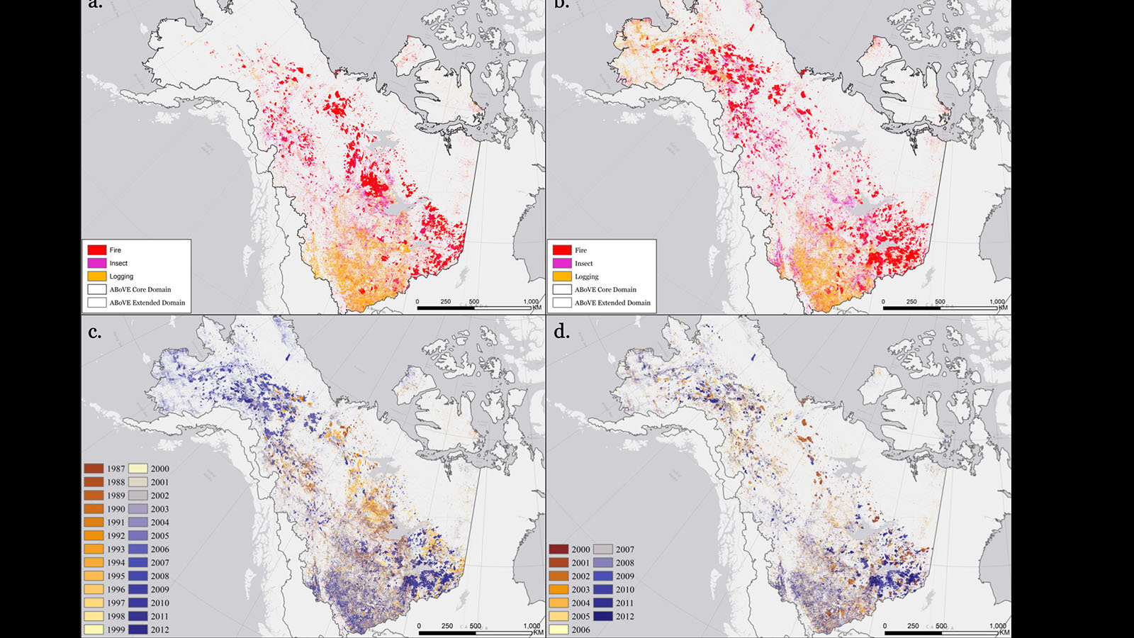


The drivers of disturbance dataset provide a more comprehensive understanding of changing environment in the Arctic region, with annually mapped fire, insect, and logging agents at 30-m spatial resolution from 1987 to 2012. Climate-induced greening/browning and ecosystem responses to the changing climate could be answered in detail with the help of these maps.
The annual disturbance map was produced by the group led by Dr. Curtis Woodcock at Boston University. The lab mainly used time series of satellite data to study forest change and its implication on terrestrial carbon budgets. This project is funded by the NASA Arctic Boreal Vulnerability Experiment (ABoVE) and filled the gap in mapping land change and drivers of disturbances in boreal and arctic environments.
